2023 Map of Shingletown
USGS Topo · Published 2023About this map
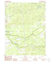
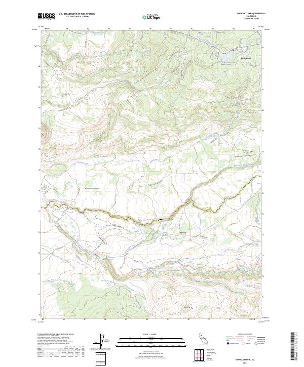
Shingletown Ridge dominates the northern half of this landscape, where the community of Shingletown sits among a network of residential roads like Bambi Dr and Chip-N-Dale Dr. The terrain drops sharply south toward the Shasta and Tehama County line, defined by the rugged descent into Eagle Canyon and the winding course of the North Fork Battle Creek. This area is heavily influenced by water management for local agriculture and power, evidenced by the intricate system of the Eagle Canyon Ditch, Wildcat Ditch, and South Ditch. To the south, the settlement of Manton serves as a hub for the surrounding ranch land, situated near the confluence of several springs and creeks. The presence of Double Creek Airpark near the eastern boundary highlights the modern utility of these high-elevation flats, while landmarks like Darrah Springs and Jackass Butte anchor the local geography.
Find a feature on this map
66 named features on this map. Tap any name to fly to it.
Don’t see what you’re looking for? This feature index may not catch every label — zoom into the map to look around manually.
Map Details
Editions of this 2023 Shingletown Map
This is the sole edition of this map. No revisions or reprints were ever made.
Historical Maps of Shingletown Through Time
6 maps found