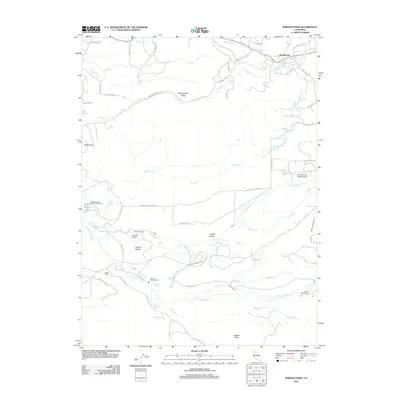
2012 Map of Shingletown
USGS Topo · Published 2012About this map
Shingletown serves as the primary upland settlement on this 2012 survey, situated along a prominent ridge that divides numerous descending watercourses. The landscape is defined by the complex hydrography of the N Fork Battle Cr and S Fork Battle Cr drainages, which support local infrastructure including the Iriskip Powerhouse and South Powerhouse. A legacy of water management is visible through an extensive network of named irrigation and power canals such as the Eagle Canyon Ditch, Wildcat Ditch, and Cross Country Ditch. Further south, the Darrah Springs State Fish Hatchery utilizes the area's natural springs. This era of the Shasta County highlands shows a mix of rural ranching at Long Ranch, recreational aviation at Double Creek Ranch Airport, and the historical path of the Emigrant Trl skirting the northern hills.
Find a feature on this map
53 named features on this map. Tap any name to fly to it.
Don’t see what you’re looking for? This feature index may not catch every label — zoom into the map to look around manually.
Map Details
Editions of this 2012 Shingletown Map
This is the sole edition of this map. No revisions or reprints were ever made.
Other maps of this area

1886 · Lassen Peak
USGS Topo · 1:250,000

1890 · Red Bluff
USGS Topo · 1:250,000

1892 · Lassen Peak
USGS Topo · 1:250,000

1894 · Lassen Peak
USGS Topo · 1:250,000

1894 · Red Bluff
USGS Topo · 1:250,000

1901 · Redding
USGS Topo · 1:125,000

1935 · Burney
USGS Topo · 1:96,000

1935 · Paynes Creek
USGS Topo · 1:96,000

1939 · Burney
USGS Topo · 1:125,000

1941 · Mineral
USGS Topo · 1:125,000