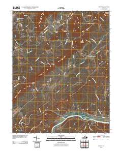
2010 Map of Shipman
USGS Topo · Published 2010About this map
Norwood sits at the confluence of the Tye River and James River, marking a historic riverfront landscape in Nelson County. The terrain is defined by a series of prominent ridges and peaks, including Findlay Mountain and Welsh Mountain, which dictate the winding paths of rural roads like Lonesome Pine Rd and Variety Mill Rd. The settlement of Shipman serves as a central hub for the upland communities of Edge Hill and Lakeview Heights, while the names of Variety Mills and Red Apple Orchard reflect the agricultural and early industrial roots of the region. Local hydrology is complex, with Rucker Run and Joe Creek carving through the Piedmont topography. To the south, Buffalo Ridge rises above the river basin, providing a natural boundary near Cunninghams Island.
Find a feature on this map
56 named features on this map. Tap any name to fly to it.
Don’t see what you’re looking for? This feature index may not catch every label — zoom into the map to look around manually.
Map Details
Editions of this 2010 Shipman Map
This is the sole edition of this map. No revisions or reprints were ever made.
Other maps of this area

1892 · Buckingham
USGS Topo · 1:125,000

1929 · Covesville
USGS Topo · 1:62,500

1935 · Covesville
USGS Topo · 1:62,500

1943 · Lovingston
USGS Topo · 1:62,500

1945 · Covesville
USGS Topo · 1:62,500

1946 · Lovingston
USGS Topo · 1:62,500

1947 · Roanoke
USGS Topo · 1:250,000

1959 · Roanoke
USGS Topo · 1:250,000

1961 · Shipman
USGS Topo · 1:62,500

1961 · Buckingham
USGS Topo · 1:62,500