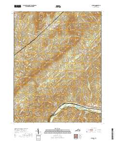
2019 Map of Shipman
USGS Topo · Published 2019About this map
Shipman and the village of Norwood anchor this 2019 survey of the Virginia interior, where the confluence of the Tye River and the James River defines the southern boundary between Nelson and Buckingham counties. The landscape is characterized by prominent peaks and ridges including Findlay Mtn, Welsh Mtn, and the long sweep of Buffalo Ridge. Significant gaps in the terrain, such as Gleasons Gap and Canada Gap, historically provided essential passage through these uplands. This modern edition captures the persistence of rural agriculture at Red Apple Orchard and the residential clusters at Lakeview Heights. Genealogists may find value in the various family-named topographic features, including Sally Powell Hollow, Purvis Hollow, and Coon Hollow, which often reflect historical land ownership and ancestral settlement patterns in this part of Nelson County.
Find a feature on this map
80 named features on this map. Tap any name to fly to it.
Don’t see what you’re looking for? This feature index may not catch every label — zoom into the map to look around manually.
Map Details
Editions of this 2019 Shipman Map
This is the sole edition of this map. No revisions or reprints were ever made.
Other maps of this area

1892 · Buckingham
USGS Topo · 1:125,000

1929 · Covesville
USGS Topo · 1:62,500

1935 · Covesville
USGS Topo · 1:62,500

1943 · Lovingston
USGS Topo · 1:62,500

1945 · Covesville
USGS Topo · 1:62,500

1946 · Lovingston
USGS Topo · 1:62,500

1947 · Roanoke
USGS Topo · 1:250,000

1959 · Roanoke
USGS Topo · 1:250,000

1961 · Shipman
USGS Topo · 1:62,500

1961 · Buckingham
USGS Topo · 1:62,500