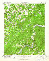
1961 Map of Shipman
USGS Topo · Published 1963About this map
The James River and its northern tributaries define the landscape of this central Virginia survey, where the Southern railroad line connects key settlements like Arrington and Shipman. The map documents a predominantly agrarian and rural economy in the early 1960s, evidenced by the Red Apple Orchard and the historic Variety Mills. Along the corridor between Nelson and Amherst counties, the social infrastructure of the time is visible through localized landmarks such as the County Training Sch, the County High Sch, and numerous congregations including St Marys Ch and Oak Grove Ch. Industrial activity is scattered across the terrain, with a Quarry near the Tye River and several Gaging Stations monitoring the complex drainage systems. To the south, the winding river valley passes through Buffalo Station and Greenway before reaching the intersection of four counties near Bent Creek, providing a detailed look at the rail-and-river transport network before the era of modern highway expansion.
Find a feature on this map
130 named features on this map. Tap any name to fly to it.
Don’t see what you’re looking for? This feature index may not catch every label — zoom into the map to look around manually.
Map Details
Editions of this 1961 Shipman Map
2 editions found

Other maps of this area

1892 · Lynchburg
USGS Topo · 1:125,000

1892 · Buckingham
USGS Topo · 1:125,000

1892 · Appomattox
USGS Topo · 1:125,000

1894 · Lexington
USGS Topo · 1:125,000

1929 · Covesville
USGS Topo · 1:62,500

1935 · Amherst
USGS Topo · 1:48,000

1935 · Covesville
USGS Topo · 1:62,500

1936 · Vesuvius
USGS Topo · 1:48,000

1939 · Amherst
USGS Topo · 1:62,500

1941 · Vesuvius
USGS Topo · 1:62,500