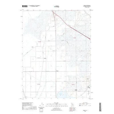
2018 Map of Shippee
USGS Topo · Published 2018About this map
Shippee and the surrounding agricultural lands of Butte County are defined by a complex network of irrigation and water management features. The landscape is crisscrossed by essential arteries like the Gold Run Canal, High Lift Lateral, and Butler Canal, which support the region's farms and orchards. To the south, the massive Thermalito Afterbay serves as a major hydrological anchor, while smaller settlements such as Ramada, Blavo, and Oroville Junction mark historic rail or road crossings. The terrain is largely level, though the Campbell Hills provide a notable rise in elevation to the southeast. Natural drainage through Cottonwood Cr, Dry Cr, and Gold Run reveals the ancient creek beds that long preceded the modern system of headgates and canals.
Find a feature on this map
41 named features on this map. Tap any name to fly to it.
Don’t see what you’re looking for? This feature index may not catch every label — zoom into the map to look around manually.
Map Details
Editions of this 2018 Shippee Map
This is the sole edition of this map. No revisions or reprints were ever made.
Other maps of this area

1888 · Marysville
USGS Topo · 1:125,000

1891 · Chico
USGS Topo · 1:125,000

1891 · Marysville
USGS Topo · 1:125,000

1893 · Chico
USGS Topo · 1:125,000

1894 · Marysville
USGS Topo · 1:125,000

1895 · Marysville
USGS Topo · 1:125,000

1895 · Chico
USGS Topo · 1:125,000

1911 · Landlow
USGS Topo · 1:31,680

1912 · Dry Creek
USGS Topo · 1:31,680

1912 · Durham
USGS Topo · 1:31,680