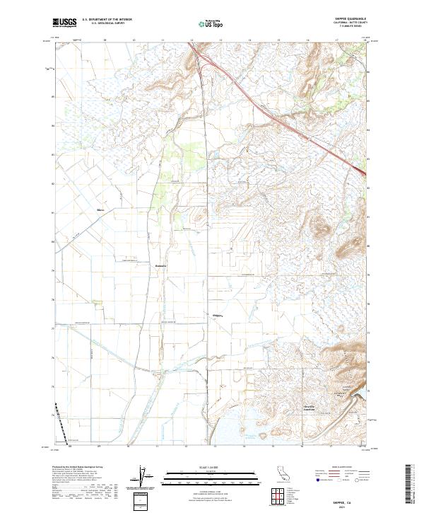
2021 Map of Shippee
USGS Topo · Published 2021About this map
The Sacramento Valley floor dominates this landscape, where a sophisticated network of water management features supports the agricultural character of Butte County. Centered on the settlement of Shippee, the area is defined by its extensive hydraulic infrastructure, including the Cherokee Canal, the Western Canal, and Main Ditch B. These artificial waterways cut across natural drainages like Dry Cr and Gold Run, illustrating the transformation of the valley for large-scale irrigation. In the southeastern corner, the topography shifts at the Campbell Hills, rising above the lowlands near Oroville Junction. To the south, the presence of the Thermalito Afterbay and various irrigation arteries like the Butler Canal and High Lift Lateral highlight the region's role in California's managed water systems. Small rural hubs such as Ramada and Blavo are linked by a grid of named roads, including Nelson Rd and Shippee Rd, that follow the underlying section lines of the Central Valley.
Find a feature on this map
49 named features on this map. Tap any name to fly to it.
Don’t see what you’re looking for? This feature index may not catch every label — zoom into the map to look around manually.
Map Details
Editions of this 2021 Shippee Map
This is the sole edition of this map. No revisions or reprints were ever made.
Other maps of this area

1888 · Marysville
USGS Topo · 1:125,000

1891 · Chico
USGS Topo · 1:125,000

1891 · Marysville
USGS Topo · 1:125,000

1893 · Chico
USGS Topo · 1:125,000

1894 · Marysville
USGS Topo · 1:125,000

1895 · Marysville
USGS Topo · 1:125,000

1895 · Chico
USGS Topo · 1:125,000

1911 · Landlow
USGS Topo · 1:31,680

1912 · Dry Creek
USGS Topo · 1:31,680

1912 · Durham
USGS Topo · 1:31,680