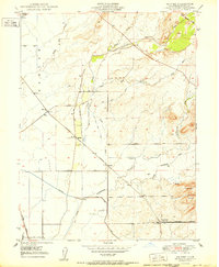
1950 Map of Shippee
USGS Topo · Published 1950About this map
Agricultural development and industrial transport intersect across the Butte County landscape, as seen in this 1950 edition map. The eastern portion is defined by the Campbell Hills, where seasonal drainages like Cottonwood Creek, Gold Run, and Clear Creek flow from the higher ground toward the valley floor. The map highlights a critical junction of California rail history, showing the routes of the Sacramento Northern, the Southern Pacific, and the Western Pacific railroads as they navigate the flatlands of the Esquon area. Small trackside settlements such as Shippee, Ramada, and Blavo serve as focal points for the surrounding orchards and fields. Infrastructure including a complex network of Levee systems and a Siphon illustrate the intensive water management required for farming. Notable landmarks for local researchers include the Floral Sch and the location at Oroville June (Tres Vias).
Find a feature on this map
25 named features on this map. Tap any name to fly to it.
Don’t see what you’re looking for? This feature index may not catch every label — zoom into the map to look around manually.
Map Details
Editions of this 1950 Shippee Map
This is the sole edition of this map. No revisions or reprints were ever made.
Other maps of this area

1888 · Marysville
USGS Topo · 1:125,000

1891 · Chico
USGS Topo · 1:125,000

1891 · Marysville
USGS Topo · 1:125,000

1893 · Chico
USGS Topo · 1:125,000

1894 · Marysville
USGS Topo · 1:125,000

1895 · Marysville
USGS Topo · 1:125,000

1895 · Chico
USGS Topo · 1:125,000

1911 · Landlow
USGS Topo · 1:31,680

1912 · Dry Creek
USGS Topo · 1:31,680

1912 · Durham
USGS Topo · 1:31,680