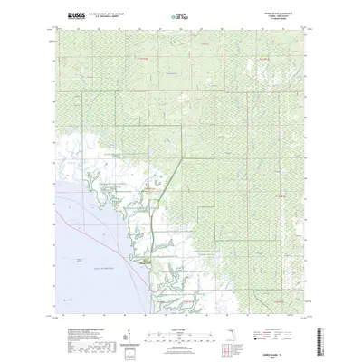
2024 Map of Shired Island
USGS Topo · Published 2024About this map
Lower Suwannee National Wildlife Refuge dominates this coastal landscape along the Gulf of Mexico, preserving a complex mosaic of tidal creeks and wetlands in Dixie County. The geography is defined by a dense hydrological network where Fishbone Creek, Butler Creek, and Amason Creek thread through the low-lying terrain. Interior features like Pocosin Swamp and California Swamp underscore the wet, undeveloped character of this region, which remains largely accessible only by unpaved roads such as Hammock Pond Rd.
Find a feature on this map
92 named features on this map. Tap any name to fly to it.
Don’t see what you’re looking for? This feature index may not catch every label — zoom into the map to look around manually.
Map Details
Editions of this 2024 Shired Island Map
This is the sole edition of this map. No revisions or reprints were ever made.
Other maps of this area

1954 · Eugene
USGS Topo · 1:24,000

1954 · Steinhatchee SE
USGS Topo · 1:24,000

1954 · Cross City SW
USGS Topo · 1:24,000

1954 · Horseshoe Beach
USGS Topo · 1:24,000

1954 · Suwannee
USGS Topo · 1:24,000

1954 · Vista
USGS Topo · 1:24,000

1954 · East Pass
USGS Topo · 1:24,000

1954 · Gainesville
USGS Topo · 1:250,000

1955 · Shired Island
USGS Topo · 1:24,000

1958 · Gainesville
USGS Topo · 1:250,000