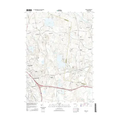
2015 Map of Shirley
USGS Topo · Published 2015About this map
Lunenburg and Shirley anchor this detailed study of the Worcester and Middlesex county borderlands, where the industrial legacy of Fitchburg and Leominster meets a landscape of glacial hills and historic watercourses. The eastern portion is defined by the Nashua River corridor, including the communal heritage of Shaker Village and the nearby Brick Tavern Cem. To the west, the expansion of North Leominster and the active rail corridor through Lunenburg Station highlight the region's role as a transportation hub.
Find a feature on this map
152 named features on this map. Tap any name to fly to it.
Don’t see what you’re looking for? This feature index may not catch every label — zoom into the map to look around manually.
Map Details
Editions of this 2015 Shirley Map
This is the sole edition of this map. No revisions or reprints were ever made.
Other maps of this area

1885 · Worcester
USGS Topo · 1:62,500

1886 · Worcester
USGS Topo · 1:62,500

1887 · Marlboro
USGS Topo · 1:62,500

1887 · Fitchburg
USGS Topo · 1:62,500

1889 · Marlboro
USGS Topo · 1:62,500

1889 · Fitchburg
USGS Topo · 1:62,500

1892 · Worcester
USGS Topo · 1:62,500

1893 · Fitchburg
USGS Topo · 1:62,500

1893 · Groton
USGS Topo · 1:62,500

1896 · Marlboro
USGS Topo · 1:62,500