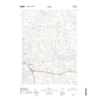
2021 Map of Shirley
USGS Topo · Published 2021About this map
Houghtons Mill Pond and the surrounding marshlands of Flurcum Swamp and Spruce Swamp characterize this corridor of the North Central Massachusetts uplands. The landscape is a complex arrangement of glacial hills, including Turkey Hill, Cowdray Hill, and The Major Hills, interspersed with dozens of water bodies and brooks. While the industrial centers of Fitchburg and Leominster anchor the southwest, the rest of the area maintains a more traditional rural pattern. The settlement of Shirley and its outlying districts like Shirley Center and North Shirley are defined by historic cemeteries such as Village Cem and Saint Anthony's Cem. Transportation history is visible through the former rail alignment now known as the Mason NH Rail-Trail ext. Trl and the presence of Lunenburg Station, showing how the railroad once integrated these hill towns into the regional economy.
Find a feature on this map
183 named features on this map. Tap any name to fly to it.
Don’t see what you’re looking for? This feature index may not catch every label — zoom into the map to look around manually.
Map Details
Editions of this 2021 Shirley Map
This is the sole edition of this map. No revisions or reprints were ever made.
Other maps of this area

1885 · Worcester
USGS Topo · 1:62,500

1886 · Worcester
USGS Topo · 1:62,500

1887 · Marlboro
USGS Topo · 1:62,500

1887 · Fitchburg
USGS Topo · 1:62,500

1889 · Marlboro
USGS Topo · 1:62,500

1889 · Fitchburg
USGS Topo · 1:62,500

1892 · Worcester
USGS Topo · 1:62,500

1893 · Fitchburg
USGS Topo · 1:62,500

1893 · Groton
USGS Topo · 1:62,500

1896 · Marlboro
USGS Topo · 1:62,500