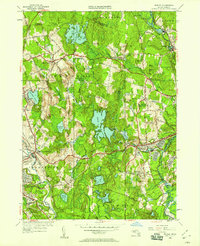
1950 Map of Shirley
USGS Topo · Published 1958About this map
The rolling landscape of north-central Massachusetts is captured here through a dense network of post-war suburban growth and historical rural infrastructure. Central to the map is Shirley, where the Boston and Maine railroad corridor parallels Trout Brook, shaping the industrial and residential core of the town. To the west, the city of Leominster displays significant development around Monoosnoc Brook, including religious and civic landmarks like St Cecelia Cemetery and St Leo Cem.
Find a feature on this map
79 named features on this map. Tap any name to fly to it.
Don’t see what you’re looking for? This feature index may not catch every label — zoom into the map to look around manually.
Map Details
Editions of this 1950 Shirley Map
This is the sole edition of this map. No revisions or reprints were ever made.
Other maps of this area

1885 · Worcester
USGS Topo · 1:62,500

1886 · Worcester
USGS Topo · 1:62,500

1887 · Marlboro
USGS Topo · 1:62,500

1887 · Fitchburg
USGS Topo · 1:62,500

1889 · Marlboro
USGS Topo · 1:62,500

1889 · Fitchburg
USGS Topo · 1:62,500

1892 · Worcester
USGS Topo · 1:62,500

1893 · Fitchburg
USGS Topo · 1:62,500

1893 · Groton
USGS Topo · 1:62,500

1896 · Marlboro
USGS Topo · 1:62,500