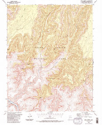
1988 Map of Shiva Temple
USGS Topo · Published 1988About this map
Shiva Temple rises as a massive, isolated plateau within the heart of Grand Canyon National Park, surrounded by a collection of towering geological formations named for global mythologies and philosophies. This 1988 survey illustrates the complex drainage systems of Crystal Creek and Dragon Creek as they carve through the ancient stone of the Granite Gorge. Along the southern edge, the Colorado River churns through the formidable Crystal Rapids, a site of significant interest for river runners. The map traces the winding path of the Tonto Trail as it skirts the inner canyon, providing a detailed look at the verticality of landmarks like the Tower of Ra, Isis Temple, and Osiris Temple. Named overlooks such as Claude Birdseye Point and Point Sublime offer spatial context for the dramatic topography of the Hindu Amphitheater.
Find a feature on this map
31 named features on this map. Tap any name to fly to it.
Don’t see what you’re looking for? This feature index may not catch every label — zoom into the map to look around manually.
Map Details
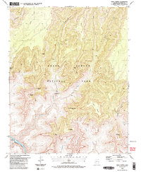
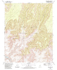
Editions of this 1988 Shiva Temple Map
3 editions found
Other maps of this area

1886 · Kaibab
USGS Topo · 1:250,000

1903 · Bright Angel
USGS Topo · 1:48,000

1906 · Bright Angel
USGS Topo · 1:48,000

1953 · Grand Canyon
USGS Topo · 1:250,000

1957 · Grand Canyon
USGS Topo · 1:250,000

1958 · Grand Canyon
USGS Topo · 1:250,000

1960 · Grand Canyon
USGS Topo · 1:250,000

1962 · Bright Angel
USGS Topo · 1:48,000

1962 · De Motte Park
USGS Topo · 1:62,500

1962 · Havasupai Point
USGS Topo · 1:62,500