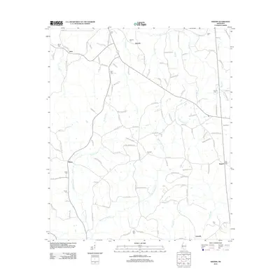
2012 Map of Shivers
USGS Topo · Published 2012About this map
Westville serves as a focal point for this rural landscape in Simpson County, where a network of family-named roads and burial grounds reveals a deep-rooted community history. The area is defined by the drainage basins of W Prong Silver Cr and Middle Prong Silver Cr, which flow through timbered and agricultural lands between Shivers and the eastern settlement of Boggan. Genealogists will find a high density of family cemeteries, such as Rose Hill Cem and Stonewall Cem, often located near crossroads or stream bends. The transition from older thoroughfares like Old Highway 13 to localized lanes like Schoolhouse Rd and Tanyard Creek Rd reflects the persistence of long-established land divisions and residential patterns in south-central Mississippi.
Find a feature on this map
107 named features on this map. Tap any name to fly to it.
Don’t see what you’re looking for? This feature index may not catch every label — zoom into the map to look around manually.
Map Details
Editions of this 2012 Shivers Map
This is the sole edition of this map. No revisions or reprints were ever made.
Other maps of this area

1953 · Hattiesburg
USGS Topo · 1:250,000

1953 · Natchez
USGS Topo · 1:250,000

1956 · Natchez
USGS Topo · 1:250,000

1958 · Hattiesburg
USGS Topo · 1:250,000

1959 · Natchez
USGS Topo · 1:250,000

1970 · Mendenhall East
USGS Topo · 1:24,000
1970 · Harrisville
USGS Topo · 1:24,000
1970 · Mendenhall West
USGS Topo · 1:24,000

1970 · New Hebron
USGS Topo · 1:24,000

1970 · Mount Carmel
USGS Topo · 1:24,000