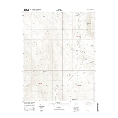
2014 Map of Shivwits
USGS Topo · Published 2014About this map
The Mojave Desert meets the eastern slopes of the Beaver Dam Mountains in this 2014 survey of Washington County. The settlement of Shivwits sits at a crossroads along the historic alignment of Old US-91, where the road follows the base of the Santa Clara Bench near the Santa Clara River. This arid landscape is defined by its drainage systems and distinct geological elevations, including the prominent Red Mountains and the wide expanse of Pahcoon Flat.
Find a feature on this map
27 named features on this map. Tap any name to fly to it.
Don’t see what you’re looking for? This feature index may not catch every label — zoom into the map to look around manually.
Map Details
Editions of this 2014 Shivwits Map
This is the sole edition of this map. No revisions or reprints were ever made.
Other maps of this area

1885 · St. George
USGS Topo · 1:250,000

1891 · St. George
USGS Topo · 1:250,000

1953 · Cedar City
USGS Topo · 1:250,000

1954 · Beaver Dam Mts NE
USGS Topo · 1:24,000

1954 · Gunlock
USGS Topo · 1:24,000

1954 · Beaver Dam Mts SE
USGS Topo · 1:24,000

1954 · St. George
USGS Topo · 1:62,500

1956 · St. George NW
USGS Topo · 1:24,000
1956 · St. George SW
USGS Topo · 1:24,000

1958 · Cedar City
USGS Topo · 1:250,000