
1956 Map of St. George NW
USGS Topo · Published 1956About this map
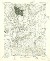
The Shivwits Indian Reservation and the agricultural settlements of Ivins and Santa Clara define this mid-1950s landscape in Washington County. Water management is the primary driver of development here, visible through the complex system of the Canal and several Water Tanks serving the Santa Clara Bench. The Santa Clara River flows through the southern portion of the map, supporting both the Santa Clara Reservoir and the Ivins Reservoir.
Find a feature on this map
23 named features on this map. Tap any name to fly to it.
Don’t see what you’re looking for? This feature index may not catch every label — zoom into the map to look around manually.
Map Details
Editions of this 1956 St. George NW Map
This is the sole edition of this map. No revisions or reprints were ever made.
Other maps of this area

1885 · St. George
USGS Topo · 1:250,000

1891 · St. George
USGS Topo · 1:250,000

1953 · Cedar City
USGS Topo · 1:250,000

1954 · Beaver Dam Mts NE
USGS Topo · 1:24,000

1954 · Gunlock
USGS Topo · 1:24,000

1954 · Beaver Dam Mts SE
USGS Topo · 1:24,000

1954 · St. George
USGS Topo · 1:62,500
1956 · St. George SE
USGS Topo · 1:24,000

1956 · St. George NE
USGS Topo · 1:24,000
1956 · St. George SW
USGS Topo · 1:24,000