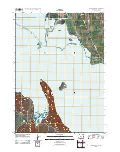
2011 Map of Shoalwater Bay
USGS Topo · Published 2011About this map
Upper Klamath Lake dominates the central landscape of this Oregon study, where the waters of Shoalwater Bay are shaped by the long, narrow protrusion of Eagle Ridge. The shoreline is a mix of marshy inlets and prominent geological features such as Eagle Point and Jumping Rock, while the solitary Bare Island sits further out in the lake. Along the northern edge, the Williamson River meanders through low-lying lands before entering the lake near a network of local roads including Toqua Rd and Modoc Point Rd.
Find a feature on this map
14 named features on this map. Tap any name to fly to it.
Don’t see what you’re looking for? This feature index may not catch every label — zoom into the map to look around manually.
Map Details
Editions of this 2011 Shoalwater Bay Map
This is the sole edition of this map. No revisions or reprints were ever made.
Other maps of this area

1889 · Klamath
USGS Topo · 1:250,000

1891 · Ashland
USGS Topo · 1:250,000

1893 · Ashland
USGS Topo · 1:250,000

1894 · Klamath
USGS Topo · 1:250,000

1897 · Ashland
USGS Topo · 1:250,000

1955 · Lake O' Woods
USGS Topo · 1:62,500

1955 · Pelican Butte
USGS Topo · 1:62,500

1955 · Klamath Falls
USGS Topo · 1:250,000

1955 · Medford
USGS Topo · 1:250,000

1957 · Medford
USGS Topo · 1:250,000