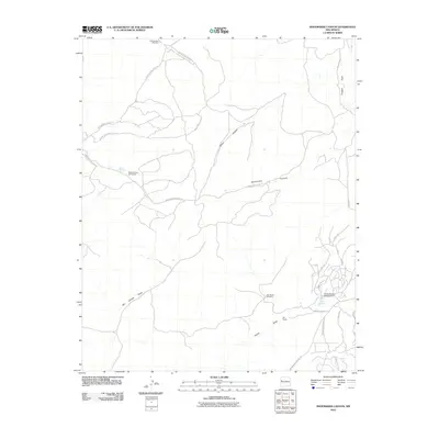
2010 Map of Shoemaker Canyon
USGS Topo · Published 2010About this map
Shoemaker Canyon and Miller Canyon define the drainage patterns of this high desert landscape within the Eastern Navajo Agency. At the turn of the 21st century, the area shows a distinct transition between open grazing land and emerging residential pockets. The settlement at Aragon Springs serves as a small hub, adjacent to the Candy Kitchen Ranch Airport. Significant infrastructure includes an extensive network of Bureau of Indian Affairs routes, such as Indian Service Route 13 and Indian Service Route 15. Evidence of a long human history is preserved in local toponyms like Indian Ruins Rd and the settlement at Ojo Pueblo, while the continued importance of water in this arid environment is marked by numerous landmarks including the Ojo Pueblo Windmill and Coa Number 1 Windmill.
Find a feature on this map
29 named features on this map. Tap any name to fly to it.
Don’t see what you’re looking for? This feature index may not catch every label — zoom into the map to look around manually.
Map Details
Editions of this 2010 Shoemaker Canyon Map
This is the sole edition of this map. No revisions or reprints were ever made.
Other maps of this area

1886 · Wingate
USGS Topo · 1:250,000

1892 · Wingate
USGS Topo · 1:250,000

1954 · Saint Johns
USGS Topo · 1:250,000

1954 · Gallup
USGS Topo · 1:250,000

1957 · Saint Johns
USGS Topo · 1:250,000

1958 · Gallup
USGS Topo · 1:250,000

1958 · Saint Johns
USGS Topo · 1:250,000

1959 · Gallup
USGS Topo · 1:250,000

1962 · Gallup
USGS Topo · 1:250,000

1962 · Saint Johns
USGS Topo · 1:250,000