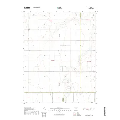
2018 Map of Shore Airport NE
USGS Topo · Published 2018About this map
N Fork Cimarron River cuts through the southwest corner of Kansas, creating a distinct topographical break in an otherwise highly organized agricultural landscape. The region is defined by its rigid section-line road network, including notable thoroughfares such as the S Big Bow Grade and S Rd B. The small Liverpool Cem sits as a quiet landmark of early settlement history, while the Lucas Airport indicates the modern importance of aviation for this rural expanse. Tracing the path of Sand Arroyo Cr as it crosses the northern sections reveals how natural drainage patterns dictated the placement of local roads and farmsteads. This survey captures a moment where high-plains geography meets the precise geometry of the Public Land Survey System at the junction of several county lines.
Find a feature on this map
38 named features on this map. Tap any name to fly to it.
Don’t see what you’re looking for? This feature index may not catch every label — zoom into the map to look around manually.
Map Details
Editions of this 2018 Shore Airport NE Map
This is the sole edition of this map. No revisions or reprints were ever made.
Other maps of this area

1891 · Larned
USGS Topo · 1:125,000

1900 · Syracuse
USGS Topo · 1:125,000

1900 · Lakin
USGS Topo · 1:125,000

1920 · Syracuse
USGS Topo · 1:125,000

1955 · Dodge City
USGS Topo · 1:250,000

1958 · Dodge City
USGS Topo · 1:250,000

1959 · Dodge City
USGS Topo · 1:250,000

1959 · Big Bow SW
USGS Topo · 1:24,000
1959 · Big Bow
USGS Topo · 1:24,000
1959 · Ulysses SW
USGS Topo · 1:24,000