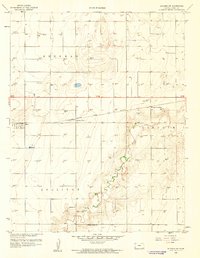
1959 Map of Ulysses SW
USGS Topo · Published 1960About this map
The North Fork Cimarron River carves a distinct, winding path through the southwest corner of Grant County, Kansas, defining the local topography in an otherwise highly organized agricultural and industrial landscape. By the late 1950s, this region was a productive intersection of transport and energy, where the Atchison Topeka and Santa Fe railroad line served small loading points like Stano and Sullivans Track. The map reveals the heavy density of the Hugoton Gas Area, with numerous Gas Wells surveyed across the townships of Sherman, Sullivan, and Lincoln. Community life is anchored by rural landmarks such as the Brethren Ch and Spring Valley Sch, providing essential geographic markers for genealogists and local historians studying the mid-century development of the High Plains. The addition of the Pioneer Co-op Spur further highlights the critical link between local grain cooperatives and the rail network.
Find a feature on this map
13 named features on this map. Tap any name to fly to it.
Don’t see what you’re looking for? This feature index may not catch every label — zoom into the map to look around manually.
Map Details
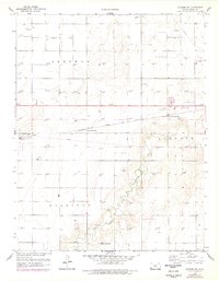
Editions of this 1959 Ulysses SW Map
2 editions found
Other maps of this area

1891 · Larned
USGS Topo · 1:125,000

1900 · Syracuse
USGS Topo · 1:125,000

1900 · Lakin
USGS Topo · 1:125,000

1920 · Syracuse
USGS Topo · 1:125,000

1955 · Dodge City
USGS Topo · 1:250,000

1958 · Dodge City
USGS Topo · 1:250,000

1959 · Dodge City
USGS Topo · 1:250,000

1959 · Ulysses NW
USGS Topo · 1:24,000

1959 · Big Bow NE
USGS Topo · 1:24,000

1959 · Ulysses
USGS Topo · 1:24,000