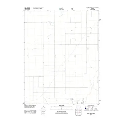
2011 Map of Shore Airport SE
USGS Topo · Published 2011About this map
The North Fork Cimarron River and the main Cimarron River corridor define this corner of Stevens County, Kansas, where the High Plains landscape is organized by a precise grid of section roads. The rural character of the region is punctuated by the isolated Dermot Cemetery, a primary landmark for genealogical research in this part of the state. This 2011 survey illustrates the modern division of agricultural and grazing lands, most notably the designated area of Pasture Number Forty. The road network, including V Blvd and 11 Mi Rd, reflects the large-scale management of the prairie, while the meandering river channels provide a distinct contrast to the straight lines of the surrounding arterial boulevards and roads.
Find a feature on this map
15 named features on this map. Tap any name to fly to it.
Don’t see what you’re looking for? This feature index may not catch every label — zoom into the map to look around manually.
Map Details
Editions of this 2011 Shore Airport SE Map
This is the sole edition of this map. No revisions or reprints were ever made.
Other maps of this area

1955 · Dodge City
USGS Topo · 1:250,000

1958 · Dodge City
USGS Topo · 1:250,000

1959 · Dodge City
USGS Topo · 1:250,000

1973 · Shore Airport SW
USGS Topo · 1:24,000

1973 · Shore Airport
USGS Topo · 1:24,000

1973 · Rolla NW
USGS Topo · 1:24,000

1973 · Rolla NE
USGS Topo · 1:24,000

1974 · Feterita
USGS Topo · 1:24,000
1974 · Wagon Bed Spring NW
USGS Topo · 1:24,000

1974 · Shore Airport SE
USGS Topo · 1:24,000