
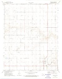
1973 Map of Shore Airport SW
USGS Topo · Published 1975About this map
The Old Santa Fe Trail (Approximate Location) cuts across the southeast corner of this southwestern Kansas landscape, marking a historic corridor of western expansion. Set within the broader Richfield terrain of Morton County, the area is defined by the winding course of the Cimarron River and its North Fork. By the early 1970s, the rural character of the region was increasingly shaped by energy extraction, evidenced by the numerous Gas Wells peppered across the sections. Local history is anchored by the Richfield Cem in the southwest, providing a vital point of reference for genealogists and researchers of this high plains community. The map illustrates a transitional period where ancestral wagon routes and modern natural resource development overlap on the same arid ground.
Find a feature on this map
6 named features on this map. Tap any name to fly to it.
Don’t see what you’re looking for? This feature index may not catch every label — zoom into the map to look around manually.
Map Details
Editions of this 1973 Shore Airport SW Map
This is the sole edition of this map. No revisions or reprints were ever made.
Other maps of this area

1955 · Dodge City
USGS Topo · 1:250,000

1958 · Dodge City
USGS Topo · 1:250,000

1959 · Dodge City
USGS Topo · 1:250,000

1973 · Shore Airport
USGS Topo · 1:24,000

1973 · Rolla NW
USGS Topo · 1:24,000

1973 · Richfield NE
USGS Topo · 1:24,000

1973 · Elkhart NE
USGS Topo · 1:24,000

1973 · Rolla NE
USGS Topo · 1:24,000
1973 · Richfield
USGS Topo · 1:24,000

1974 · Shore Airport SE
USGS Topo · 1:24,000