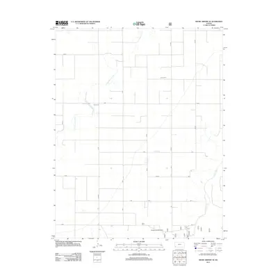
2012 Map of Shore Airport SE
USGS Topo · Published 2012About this map
The High Plains landscape of Stevens County is defined by the winding course of the N Fork Cimarron River as it cuts through a grid of rural section roads. This 2012 survey captures the quiet geographic centers of the community, most notably Dermot Hall and the nearby Dermot Cem, which serve as primary landmarks in an area otherwise dominated by expansive agricultural tracts like Pasture Number Forty. The road network is meticulously detailed, showing the transition from named thoroughfares like Z Blvd to essential county routes such as Co Rd 26 and Road W. In the southeastern corner, the confluence and drainage patterns of the Cimarron River become the primary topographical feature, illustrating the importance of these watercourses in an arid environment.
Find a feature on this map
25 named features on this map. Tap any name to fly to it.
Don’t see what you’re looking for? This feature index may not catch every label — zoom into the map to look around manually.
Map Details
Editions of this 2012 Shore Airport SE Map
This is the sole edition of this map. No revisions or reprints were ever made.
Other maps of this area

1955 · Dodge City
USGS Topo · 1:250,000

1958 · Dodge City
USGS Topo · 1:250,000

1959 · Dodge City
USGS Topo · 1:250,000

1973 · Shore Airport SW
USGS Topo · 1:24,000

1973 · Shore Airport
USGS Topo · 1:24,000

1973 · Rolla NW
USGS Topo · 1:24,000

1973 · Rolla NE
USGS Topo · 1:24,000

1974 · Feterita
USGS Topo · 1:24,000
1974 · Wagon Bed Spring NW
USGS Topo · 1:24,000

1974 · Shore Airport SE
USGS Topo · 1:24,000