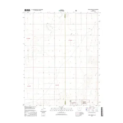
2015 Map of Shore Airport SE
USGS Topo · Published 2015About this map
Cimarron National Grassland defines the southern portion of this landscape along the border of Stevens and Morton counties. The high plains terrain is carved by the meandering path of the N Fork Cimarron River in the northwest and the Cimarron River in the southeast, illustrating the drainage patterns of this arid region. The presence of the Dermot Cem provides a specific point of interest for genealogists and local historians, serving as a lone marker of earlier settlement in an area dominated by large-scale land management and conservation. The map also includes specific administrative designations such as Pasture Number Forty, which reflects the systematic division of public lands within the Cimarron NG. This survey offers a clear view of the intersection of natural river systems and federal land use in the southwestern corner of Kansas.
Find a feature on this map
11 named features on this map. Tap any name to fly to it.
Don’t see what you’re looking for? This feature index may not catch every label — zoom into the map to look around manually.
Map Details
Editions of this 2015 Shore Airport SE Map
This is the sole edition of this map. No revisions or reprints were ever made.
Other maps of this area

1955 · Dodge City
USGS Topo · 1:250,000

1958 · Dodge City
USGS Topo · 1:250,000

1959 · Dodge City
USGS Topo · 1:250,000

1973 · Shore Airport SW
USGS Topo · 1:24,000

1973 · Shore Airport
USGS Topo · 1:24,000

1973 · Rolla NW
USGS Topo · 1:24,000

1973 · Rolla NE
USGS Topo · 1:24,000

1974 · Feterita
USGS Topo · 1:24,000
1974 · Wagon Bed Spring NW
USGS Topo · 1:24,000

1974 · Shore Airport SE
USGS Topo · 1:24,000