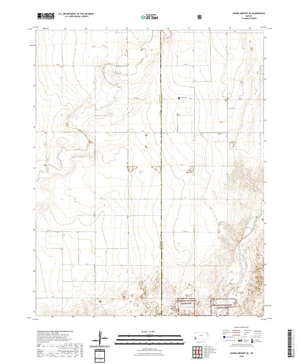
2022 Map of Shore Airport SE
USGS Topo · Published 2022About this map
The high plains of southwest Kansas meet along the county line between Morton Co and Stevens Co, where the landscape is defined by the wide, winding courses of the N Fork Cimarron River and the main Cimarron River. This 2022 survey captures a transition from the rigid section-line road grid of rural agriculture to the federally managed lands of the Cimarron National Grassland in the southern portion of the map. Traces of early settlement and regional history are preserved at the Dermot Cem near AA Blvd, while the southern reaches of the map include specific land management units like Pasture Number Forty. The terrain is characterized by the subtle elevation changes of the river valleys cutting through the flat upland plains, providing a detailed look at the water-scarce geography of the western edge of the state.
Find a feature on this map
29 named features on this map. Tap any name to fly to it.
Don’t see what you’re looking for? This feature index may not catch every label — zoom into the map to look around manually.
Map Details
Editions of this 2022 Shore Airport SE Map
This is the sole edition of this map. No revisions or reprints were ever made.
Other maps of this area

1955 · Dodge City
USGS Topo · 1:250,000

1958 · Dodge City
USGS Topo · 1:250,000

1959 · Dodge City
USGS Topo · 1:250,000

1973 · Shore Airport SW
USGS Topo · 1:24,000

1973 · Shore Airport
USGS Topo · 1:24,000

1973 · Rolla NW
USGS Topo · 1:24,000

1973 · Rolla NE
USGS Topo · 1:24,000

1974 · Feterita
USGS Topo · 1:24,000
1974 · Wagon Bed Spring NW
USGS Topo · 1:24,000

1974 · Shore Airport SE
USGS Topo · 1:24,000