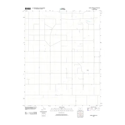
2010 Map of Shore Airport
USGS Topo · Published 2010About this map
Shore Airport stands as the central landmark in this high-plains landscape of western Kansas, where the survey reveals a strictly organized grid of agricultural roads and sparse watercourses. The drainage of Sand Arroyo Creek meanders through the northern section, providing a rare natural break in the geometric regularity of the section lines. This area of Stanton County is defined by its vast stretches of open land, interconnected by a systematic network of thoroughfares including S Rd K, S Rd F, and E Rd 19. The map's detail shows a region heavily influenced by the Rectangular Survey System, where infrastructure is precisely aligned to the compass. For the local researcher, these labels provide a clear view of the transportation corridors and land divisions in the early twenty-first century.
Find a feature on this map
13 named features on this map. Tap any name to fly to it.
Don’t see what you’re looking for? This feature index may not catch every label — zoom into the map to look around manually.
Map Details
Editions of this 2010 Shore Airport Map
This is the sole edition of this map. No revisions or reprints were ever made.
Other maps of this area

1900 · Syracuse
USGS Topo · 1:125,000

1920 · Syracuse
USGS Topo · 1:125,000

1955 · Dodge City
USGS Topo · 1:250,000

1958 · Dodge City
USGS Topo · 1:250,000

1959 · Dodge City
USGS Topo · 1:250,000

1959 · Big Bow SW
USGS Topo · 1:24,000
1959 · Big Bow
USGS Topo · 1:24,000

1973 · Shore Airport SW
USGS Topo · 1:24,000

1973 · Shore Airport
USGS Topo · 1:24,000

1973 · Richfield NE
USGS Topo · 1:24,000