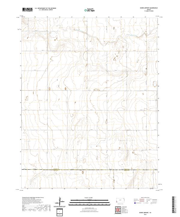
2022 Map of Shore Airport
USGS Topo · Published 2022About this map
Sand Arroyo Cr meanders across the northern reaches of this high plains landscape, defining the topography of a region dominated by large-scale agricultural divisions. The map highlights the intersection of Stanton Co and Morton Co, tracing the political boundary through a precise grid of rural roads such as Co Rd DD and Co Rd 24. This layout reflects the systematic land management of the Kansas prairie, where the Public Land Survey System creates a repeating pattern of sections and townships. While the terrain appears level, the subtle drainage patterns of the arroyo suggest the intermittent water flow that has historically shaped ranching and farming practices in this southwestern corner of the state.
Find a feature on this map
27 named features on this map. Tap any name to fly to it.
Don’t see what you’re looking for? This feature index may not catch every label — zoom into the map to look around manually.
Map Details
Editions of this 2022 Shore Airport Map
This is the sole edition of this map. No revisions or reprints were ever made.
Other maps of this area

1900 · Syracuse
USGS Topo · 1:125,000

1920 · Syracuse
USGS Topo · 1:125,000

1955 · Dodge City
USGS Topo · 1:250,000

1958 · Dodge City
USGS Topo · 1:250,000

1959 · Dodge City
USGS Topo · 1:250,000

1959 · Big Bow SW
USGS Topo · 1:24,000
1959 · Big Bow
USGS Topo · 1:24,000

1973 · Shore Airport SW
USGS Topo · 1:24,000

1973 · Shore Airport
USGS Topo · 1:24,000

1973 · Richfield NE
USGS Topo · 1:24,000