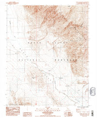
1984 Map of Shore Line Butte
USGS Topo · Published 1984About this map
Death Valley dominates this 1984 survey, revealing a landscape of extreme elevations and historic desert mining operations. The Black Mountains rise sharply to the east, home to the Ashford Mine and the Desert Hound Mine, connected by deep drainages like Scottys Canyon and Ashford Canyon. Along the valley floor, the ephemeral Amargosa River flows toward The Narrows, passing near the Ashford Mill (Ruins) and the geological landmark of Shore Line Butte.
Find a feature on this map
25 named features on this map. Tap any name to fly to it.
Don’t see what you’re looking for? This feature index may not catch every label — zoom into the map to look around manually.
Map Details
Editions of this 1984 Shore Line Butte Map
2 editions found
Other maps of this area

1908 · Furnace Creek
USGS Topo · 1:250,000

1910 · Furnace Creek
USGS Topo · 1:250,000

1933 · Avawatz Mountains
USGS Topo · 1:250,000

1947 · Trona
USGS Topo · 1:250,000

1948 · Trona
USGS Topo · 1:250,000

1948 · Death Valley
USGS Topo · 1:250,000

1950 · Wingate Wash
USGS Topo · 1:62,500

1950 · Confidence Hills
USGS Topo · 1:62,500

1951 · Funeral Peak
USGS Topo · 1:62,500

1952 · Bennetts Well
USGS Topo · 1:62,500