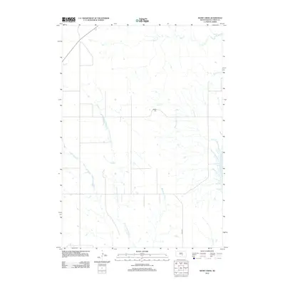
2012 Map of Short Creek
USGS Topo · Published 2012About this map
Lewis Hill rises as a prominent landmark in this segment of Lyman County, overlooking a complex drainage system that feeds into the Missouri River basin. The landscape is defined by the winding course of the N Fork American Crow Cr, which snakes southward across the prairie, joined by various tributaries including Short Cr and Clates Cr. In the eastern reaches, the terrain descends toward the vast waters of Lake Francis Case, a significant reservoir formed by the damming of the Missouri River. The map documents a sparse, rural infrastructure typical of the Great Plains, where long-distance thoroughfares like 336th Ave provide the primary framework for movement between isolated homesteads and grazing lands. Water remains the critical geographical focus, evidenced by the named drainages of De Smet Cr and Pontoon Cr that segment the rolling ranch land.
Find a feature on this map
8 named features on this map. Tap any name to fly to it.
Don’t see what you’re looking for? This feature index may not catch every label — zoom into the map to look around manually.
Map Details
Editions of this 2012 Short Creek Map
This is the sole edition of this map. No revisions or reprints were ever made.
Other maps of this area

1935 · Chamberlain
USGS Topo · 1:62,500

1939 · Chamberlain
USGS Topo · 1:62,500

1952 · Reliance SE
USGS Topo · 1:24,000

1952 · Oacoma
USGS Topo · 1:24,000

1953 · Huron
USGS Topo · 1:250,000

1954 · Huron
USGS Topo · 1:250,000

1955 · Mitchell
USGS Topo · 1:250,000

1959 · Mitchell
USGS Topo · 1:250,000

1966 · Big Bend Dam SE
USGS Topo · 1:24,000

1966 · Big Bend Dam
USGS Topo · 1:24,000