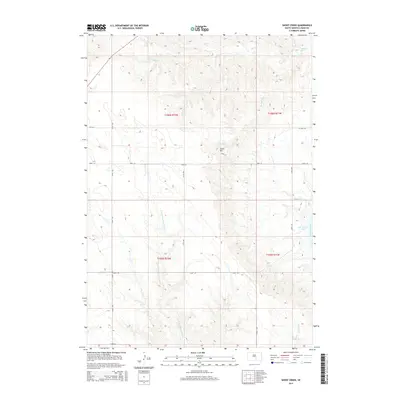
2015 Map of Short Creek
USGS Topo · Published 2015About this map
Lake Francis Case and the wide Missouri River define the eastern edge of this Lyman County landscape, where the prairie breaks into complex drainage systems. The terrain is marked by prominent elevations like Lewis Hill, which stands above a network of seasonal watercourses including Short Creek, De Smet Creek, and the winding N Fork American Crow Creek. This 2015 survey illustrates the section-line grid system typical of the Great Plains, with corridors such as 238th St and 337th Ave providing access to the vast interior rangelands. The presence of Ft Hale Rd near the river bluffs hints at the region's long history of transit and surveying, while labels for Clates Creek and Pontoon Creek trace the natural flow of water toward the reservoir.
Find a feature on this map
21 named features on this map. Tap any name to fly to it.
Don’t see what you’re looking for? This feature index may not catch every label — zoom into the map to look around manually.
Map Details
Editions of this 2015 Short Creek Map
This is the sole edition of this map. No revisions or reprints were ever made.
Other maps of this area

1935 · Chamberlain
USGS Topo · 1:62,500

1939 · Chamberlain
USGS Topo · 1:62,500

1952 · Reliance SE
USGS Topo · 1:24,000

1952 · Oacoma
USGS Topo · 1:24,000

1953 · Huron
USGS Topo · 1:250,000

1954 · Huron
USGS Topo · 1:250,000

1955 · Mitchell
USGS Topo · 1:250,000

1959 · Mitchell
USGS Topo · 1:250,000

1966 · Big Bend Dam SE
USGS Topo · 1:24,000

1966 · Big Bend Dam
USGS Topo · 1:24,000