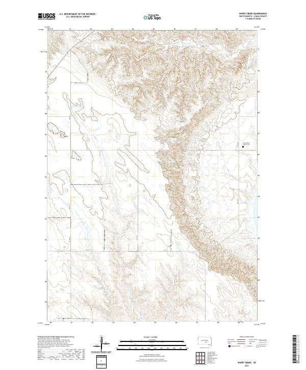
2021 Map of Short Creek
USGS Topo · Published 2021About this map
Lewis Hill rises as a prominent landmark in this segment of Lyman County, overlooking a network of seasonal drainages including Short Cr and De Smet Cr. This 2021 landscape is characterized by its drainage patterns, with Crow Cr and the N Fork American Crow Cr winding through the western sections. The map records essential local landmarks such as Saint Albans Church Cem, providing critical geographic data for genealogists and local historians tracing the development of rural South Dakota. The survey also details the modern transportation grid, noting routes like Bia RD 5 and several rural avenues such as 337 Ave and 340th Ave, which define the section lines and connect the sparse agricultural holdings of the Missouri River plateau.
Find a feature on this map
19 named features on this map. Tap any name to fly to it.
Don’t see what you’re looking for? This feature index may not catch every label — zoom into the map to look around manually.
Map Details
Editions of this 2021 Short Creek Map
This is the sole edition of this map. No revisions or reprints were ever made.
Other maps of this area

1935 · Chamberlain
USGS Topo · 1:62,500

1939 · Chamberlain
USGS Topo · 1:62,500

1952 · Reliance SE
USGS Topo · 1:24,000

1952 · Oacoma
USGS Topo · 1:24,000

1953 · Huron
USGS Topo · 1:250,000

1954 · Huron
USGS Topo · 1:250,000

1955 · Mitchell
USGS Topo · 1:250,000

1959 · Mitchell
USGS Topo · 1:250,000

1966 · Big Bend Dam SE
USGS Topo · 1:24,000

1966 · Big Bend Dam
USGS Topo · 1:24,000