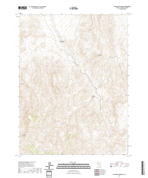
2021 Map of Shoshone Meadows
USGS Topo · Published 2021About this map
Shoshone Meadows occupies a high-altitude basin within the Clan Alpine Mountains of central Nevada, a landscape defined by its reliance on isolated water sources. This 2021 survey illustrates a complex network of springs, including Shoshone Springs, Big Shoshone Spring, and Little Shoshone Spring, which have historically served as critical lifelines for livestock and wildlife in this arid environment. The terrain is deeply incised by drainages such as Shoshone Creek Canyon and Mud Spring Canyon, showcasing the erosional forces that shape the Great Basin. While lacking permanent modern settlements, the map details the Public Land Survey System grid across T23N and T22N, providing essential data for land management and identifying family-named landmarks like Hoyt Canyon.
Find a feature on this map
13 named features on this map. Tap any name to fly to it.
Don’t see what you’re looking for? This feature index may not catch every label — zoom into the map to look around manually.
Map Details
Editions of this 2021 Shoshone Meadows Map
This is the sole edition of this map. No revisions or reprints were ever made.
Other maps of this area

1955 · Millett
USGS Topo · 1:250,000

1959 · Millett
USGS Topo · 1:250,000

1966 · Clan Alpine Ranch
USGS Topo · 1:62,500

1966 · Humboldt Salt Marsh
USGS Topo · 1:62,500

1966 · Shoshone Meadows
USGS Topo · 1:62,500

1966 · Edwards Creek Valley
USGS Topo · 1:62,500

1983 · Edwards Creek Valley
USGS Topo · 1:100,000
1990 · Hole In The Wall
USGS Topo · 1:24,000
1990 · Bernice Canyon
USGS Topo · 1:24,000
1990 · Byers Canyon
USGS Topo · 1:24,000