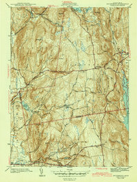
1943 Map of Shutesbury
USGS Topo · Published 1943About this map
Quabbin Reservoir dominates the eastern edge of this landscape, its waters having recently reshaped the topography of Franklin and Hampshire Counties following the mid-century valley inundations. The map captures a moment when the Daniel Shays Highway served as a primary north-south artery through the rugged hills, connecting settlements like Shutesbury and Pelham. In the valley to the west, numerous small water bodies and catchments such as Atkins Reservoir and Baker Reservoir reflect the region's complex hydrological management for local populations. Genealogy researchers will find significant detail in the placement of rural landmarks, including the Rhodes Sch in the south and the Valley Cem near West Pelham. Small, dispersed hamlets like Moores Corner, Dudleyville, and Baconville are mapped with precision, showing the traditional crossroads settlement patterns that defined this section of central Massachusetts during the early 1940s.
Find a feature on this map
62 named features on this map. Tap any name to fly to it.
Don’t see what you’re looking for? This feature index may not catch every label — zoom into the map to look around manually.
Map Details
Editions of this 1943 Shutesbury Map
4 editions found
Other maps of this area

1885 · Northampton
USGS Topo · 1:62,500

1886 · Northampton
USGS Topo · 1:62,500

1887 · Warwick
USGS Topo · 1:62,500

1887 · Belchertown
USGS Topo · 1:62,500

1889 · Warwick
USGS Topo · 1:62,500

1890 · Belchertown
USGS Topo · 1:62,500

1890 · Greenfield
USGS Topo · 1:62,500

1891 · Northampton
USGS Topo · 1:62,500

1893 · Northampton
USGS Topo · 1:62,500

1893 · Belchertown
USGS Topo · 1:62,500