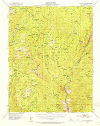
1953 Map of Shuteye Peak
USGS Topo · Published 1955About this map
The high Sierra National Forest dominates this mid-century survey, centered on the prominent Shuteye Peak and its VABM 8351 Lookout. The landscape is a network of cattle camps and summer retreats, including Ryans Upper Cow Camp, Gaggs Camp, and the Future Farmers of America Camp. In the lower elevations, industrial activity is evident at Central Camp and several mineral prospects like the North McSwain Mine and Weissman Mine.
Find a feature on this map
94 named features on this map. Tap any name to fly to it.
Don’t see what you’re looking for? This feature index may not catch every label — zoom into the map to look around manually.
Map Details
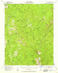
Editions of this 1953 Shuteye Peak Map
3 editions found

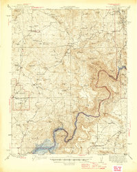
Other maps of this area

1897 · Yosemite
USGS Topo · 1:125,000

1900 · Yosemite
USGS Topo · 1:125,000

1901 · Mt. Lyell
USGS Topo · 1:125,000

1903 · Yosemite
USGS Topo · 1:125,000

1904 · Kaiser
USGS Topo · 1:125,000

1909 · Yosemite
USGS Topo · 1:125,000

1912 · Mariposa
USGS Topo · 1:125,000

1942 · Millerton Lake
USGS Topo · 1:62,500
1945 · Millerton Lake
USGS Topo · 1:62,500

1947 · Mariposa
USGS Topo · 1:250,000