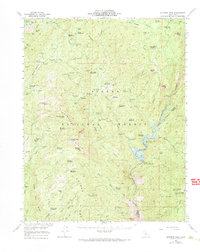
1953 Map of Shuteye Peak
USGS Topo · Published 1968About this map
The high Sierra country of the Sierra National Forest is defined here by the deep carving of the San Joaquin River and the rugged granite crests of Whisky Ridge and Chiquito Ridge. At the center of the survey, Shuteye Peak rises as a dominant landmark, hosting the Shuteye Lookout and overlooking a complex network of seasonal cattle camps and high-altitude meadows. Locations like Ryans Lower Cow Camp, Kates Cow Camp, and Buchenau Cabin point to the area's history of summer grazing.
Find a feature on this map
88 named features on this map. Tap any name to fly to it.
Don’t see what you’re looking for? This feature index may not catch every label — zoom into the map to look around manually.
Map Details
Editions of this 1953 Shuteye Peak Map
3 editions found

Other maps of this area

1897 · Yosemite
USGS Topo · 1:125,000

1900 · Yosemite
USGS Topo · 1:125,000

1901 · Mt. Lyell
USGS Topo · 1:125,000

1903 · Yosemite
USGS Topo · 1:125,000

1904 · Kaiser
USGS Topo · 1:125,000

1909 · Yosemite
USGS Topo · 1:125,000

1912 · Mariposa
USGS Topo · 1:125,000

1942 · Millerton Lake
USGS Topo · 1:62,500

1945 · Millerton Lake
USGS Topo · 1:62,500

1947 · Mariposa
USGS Topo · 1:250,000