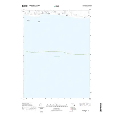
2018 Map of Siasconset OE S
USGS Topo · Published 2018About this map
The south shore of Nantucket is defined by its continuous stretch of sandy coastlines and the infrastructure supporting the island's mid-century and modern development. This 2018 survey highlights the coastal interface where the Atlantic Ocean meets a series of distinct beaches, including Miacomet Beach, Surfside Beach, Nobadeer Beach, and Madequecham Beach. The area is characterized by a grid of residential access roads like S Shore Rd and Tom Nevers Rd that navigate the low-lying terrain behind the dunes. A primary landmark of the region is the Nantucket Memorial Airport, whose runways extend toward the shoreline, anchoring the island's transportation network. The map illustrates the spatial relationship between the airport’s industrial footprint and the residential corridors that have filled the spaces between the marshes and the sea, such as those along Madequecham Valley Rd.
Find a feature on this map
21 named features on this map. Tap any name to fly to it.
Don’t see what you’re looking for? This feature index may not catch every label — zoom into the map to look around manually.
Map Details
Editions of this 2018 Siasconset OE S Map
This is the sole edition of this map. No revisions or reprints were ever made.
Other maps of this area

1889 · Nantucket
USGS Topo · 1:62,500

1893 · Nantucket
USGS Topo · 1:62,500

1901 · Nantucket
USGS Topo · 1:62,500

1942 · Nantucket
USGS Topo · 1:125,000

1945 · Nantucket
USGS Topo · 1:31,680

1945 · Siasconset
USGS Topo · 1:31,680

1947 · Providence
USGS Topo · 1:250,000

1948 · Providence
USGS Topo · 1:250,000
1951 · Siasconset
USGS Topo · 1:31,680
1951 · Nantucket
USGS Topo · 1:31,680