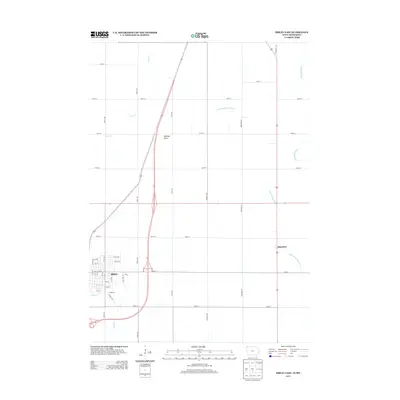
2013 Map of Sibley East
USGS Topo · Published 2013About this map
Hawkeye Point stands as a prominent geographic landmark in this corner of northwest Iowa, surrounded by a precise grid of agricultural roads. The town of Sibley occupies the southwestern portion of the map, showing a developed street plan including Maple Drive and Elm Drive alongside a series of numbered avenues and streets. To the east, the small settlement of Allendorf sits along the Little Ocheyedan River, which meanders through the prairie landscape before joining the larger Ocheyedan River. The drainage pattern is further defined by Otter Creek, which flows near the Sibley city limits. This 2013 survey illustrates the modern transportation network, dominated by the intersection of major routes and a strictly maintained system of section-line roads like Oriole Avenue and Pierce Avenue that facilitate the region's intensive farming operations.
Find a feature on this map
39 named features on this map. Tap any name to fly to it.
Don’t see what you’re looking for? This feature index may not catch every label — zoom into the map to look around manually.
Map Details
Editions of this 2013 Sibley East Map
This is the sole edition of this map. No revisions or reprints were ever made.
Other maps of this area

1954 · Fairmont
USGS Topo · 1:250,000

1958 · Fairmont
USGS Topo · 1:250,000

1960 · Bigelow
USGS Topo · 1:24,000

1960 · Worthington South
USGS Topo · 1:24,000

1967 · Rushmore
USGS Topo · 1:24,000

1972 · Ashton
USGS Topo · 1:24,000

1972 · Ocheyedan
USGS Topo · 1:24,000

1972 · Sibley West
USGS Topo · 1:24,000

1972 · Cloverdale
USGS Topo · 1:24,000
1972 · Sibley East
USGS Topo · 1:24,000