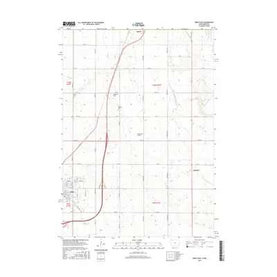
2015 Map of Sibley East
USGS Topo · Published 2015About this map
Hawkeye Point, the highest natural point in Iowa, stands as a prominent landmark on this prairie landscape within the Coteau des Prairies upland. The settlement of Sibley anchors the southwestern corner, showing a detailed grid of streets like 9th St and NW Blvd near the local golf course. To the east, the small community of Allendorf sits along the rail corridor, while Bigelow marks the northern edge of the survey at the Minnesota border.
Find a feature on this map
39 named features on this map. Tap any name to fly to it.
Don’t see what you’re looking for? This feature index may not catch every label — zoom into the map to look around manually.
Map Details
Editions of this 2015 Sibley East Map
This is the sole edition of this map. No revisions or reprints were ever made.
Other maps of this area

1954 · Fairmont
USGS Topo · 1:250,000

1958 · Fairmont
USGS Topo · 1:250,000

1960 · Bigelow
USGS Topo · 1:24,000

1960 · Worthington South
USGS Topo · 1:24,000

1967 · Rushmore
USGS Topo · 1:24,000

1972 · Ashton
USGS Topo · 1:24,000

1972 · Ocheyedan
USGS Topo · 1:24,000

1972 · Sibley West
USGS Topo · 1:24,000

1972 · Cloverdale
USGS Topo · 1:24,000
1972 · Sibley East
USGS Topo · 1:24,000