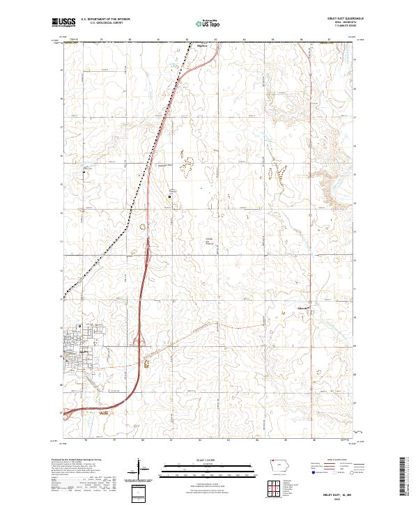
2022 Map of Sibley East
USGS Topo · Published 2022About this map
Hawkeye Point, the highest natural point in Iowa, rises within this section of Osceola County atop the prominent Coteau des Prairies. The landscape is defined by the glacial till of the upland plateau, drained by the Ocheyedan River and the Little Ocheyedan River as they wind through agricultural fields. The county seat of Sibley dominates the southwestern corner, anchored by the Osceola County Courthouse and a grid of streets that transition into a network of rural roads such as Co HWY l40. Local history and genealogy are preserved at the North Sibley Cem and Wilson Township Cem, while the Ed Winkel Memorial Trl offers a modern recreational path following a historic transport corridor near the settlements of Allendorf and Bigelow.
Find a feature on this map
27 named features on this map. Tap any name to fly to it.
Don’t see what you’re looking for? This feature index may not catch every label — zoom into the map to look around manually.
Map Details
Editions of this 2022 Sibley East Map
This is the sole edition of this map. No revisions or reprints were ever made.
Other maps of this area

1954 · Fairmont
USGS Topo · 1:250,000

1958 · Fairmont
USGS Topo · 1:250,000

1960 · Bigelow
USGS Topo · 1:24,000

1960 · Worthington South
USGS Topo · 1:24,000

1967 · Rushmore
USGS Topo · 1:24,000

1972 · Ashton
USGS Topo · 1:24,000

1972 · Ocheyedan
USGS Topo · 1:24,000

1972 · Sibley West
USGS Topo · 1:24,000

1972 · Cloverdale
USGS Topo · 1:24,000
1972 · Sibley East
USGS Topo · 1:24,000