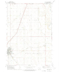
1972 Map of Sibley East
USGS Topo · Published 1975About this map
The city of Sibley serves as the focal point of this Northwest Iowa landscape, positioned at the junction of two major Midwestern rail lines. At the time of this 1972 survey, the Chicago and North Western and the Chicago Rock Island and Pacific railroads crisscrossed the terrain, defining the local economy and settlement pattern. The map reveals the civic structure of the region through landmarks like the High Sch, Hosp, and the Townhall in Wilson township, alongside smaller agricultural hubs like Allendorf.
Find a feature on this map
22 named features on this map. Tap any name to fly to it.
Don’t see what you’re looking for? This feature index may not catch every label — zoom into the map to look around manually.
Map Details
Editions of this 1972 Sibley East Map
This is the sole edition of this map. No revisions or reprints were ever made.
Other maps of this area

1954 · Fairmont
USGS Topo · 1:250,000

1958 · Fairmont
USGS Topo · 1:250,000

1960 · Bigelow
USGS Topo · 1:24,000

1960 · Worthington South
USGS Topo · 1:24,000

1967 · Rushmore
USGS Topo · 1:24,000

1972 · Ashton
USGS Topo · 1:24,000

1972 · Ocheyedan
USGS Topo · 1:24,000

1972 · Sibley West
USGS Topo · 1:24,000

1972 · Cloverdale
USGS Topo · 1:24,000
1972 · Melvin
USGS Topo · 1:24,000