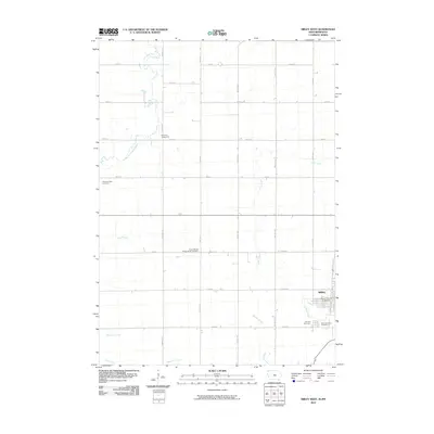
2010 Map of Sibley West
USGS Topo · Published 2010About this map
The western edges of Sibley anchor this corner of Osceola County, where the transition from town lots to open prairie is marked by the Osceola County Fairgrounds. The landscape is defined by the steady, orthogonal grid of section-line roads like Monroe Ave and 160th St, characteristic of the rural Midwest's agricultural development. Watercourses such as the Little Rock River and Otter Creek meander across this grid, creating natural deviations in an otherwise strictly surveyed territory.
Find a feature on this map
31 named features on this map. Tap any name to fly to it.
Don’t see what you’re looking for? This feature index may not catch every label — zoom into the map to look around manually.
Map Details
Editions of this 2010 Sibley West Map
This is the sole edition of this map. No revisions or reprints were ever made.
Other maps of this area

1954 · Fairmont
USGS Topo · 1:250,000

1958 · Fairmont
USGS Topo · 1:250,000

1960 · Bigelow
USGS Topo · 1:24,000

1967 · Rushmore
USGS Topo · 1:24,000

1967 · Adrian SW
USGS Topo · 1:24,000

1972 · Ashton
USGS Topo · 1:24,000
1972 · Little Rock
USGS Topo · 1:24,000

1972 · Sibley West
USGS Topo · 1:24,000
1972 · George East
USGS Topo · 1:24,000

1972 · Cloverdale
USGS Topo · 1:24,000