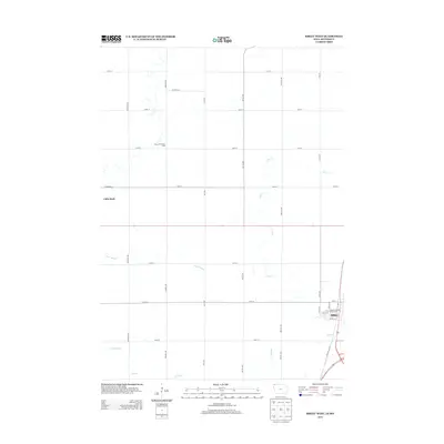
2013 Map of Sibley West
USGS Topo · Published 2013About this map
Sibley serves as the primary municipal center in this section of Osceola County, located along the eastern edge of the quadrangle. The town's grid is anchored by the Osceola County Fairgrounds and the bypass corridor of Highway 60 Blvd. To the west, the landscape transitions into a rhythmic pattern of agricultural sections defined by a precise road network, including McKinley Ave and Nettle Ave, which cross several meandering waterways.
Find a feature on this map
33 named features on this map. Tap any name to fly to it.
Don’t see what you’re looking for? This feature index may not catch every label — zoom into the map to look around manually.
Map Details
Editions of this 2013 Sibley West Map
This is the sole edition of this map. No revisions or reprints were ever made.
Other maps of this area

1954 · Fairmont
USGS Topo · 1:250,000

1958 · Fairmont
USGS Topo · 1:250,000

1960 · Bigelow
USGS Topo · 1:24,000

1967 · Rushmore
USGS Topo · 1:24,000

1967 · Adrian SW
USGS Topo · 1:24,000

1972 · Ashton
USGS Topo · 1:24,000
1972 · Little Rock
USGS Topo · 1:24,000

1972 · Sibley West
USGS Topo · 1:24,000
1972 · George East
USGS Topo · 1:24,000

1972 · Cloverdale
USGS Topo · 1:24,000