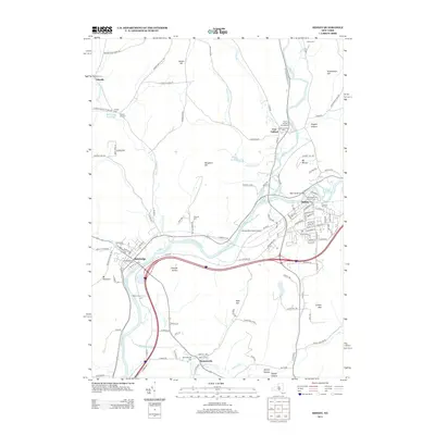
2013 Map of Sidney
USGS Topo · Published 2013About this map
Sidney and Bainbridge occupy the riverfronts along the Susquehanna River and Unadilla River in this detailed 2013 survey. The settlement pattern follows the fertile valleys and winding waterways, with smaller hamlets like Bennettsville and East Guilford marking the junctions of rural roads. Genealogists will find an exceptional density of burial sites throughout the landscape, from the large Prospect Hill Cem in Sidney to more secluded family grounds like Pearsall Cem and Yaleville Cem.
Find a feature on this map
135 named features on this map. Tap any name to fly to it.
Don’t see what you’re looking for? This feature index may not catch every label — zoom into the map to look around manually.
Map Details
Editions of this 2013 Sidney Map
This is the sole edition of this map. No revisions or reprints were ever made.
Other maps of this area

1902 · Coventry
USGS Topo · 1:62,500

1904 · Oxford
USGS Topo · 1:62,500

1905 · Nineveh
USGS Topo · 1:62,500

1915 · Unadilla
USGS Topo · 1:62,500

1918 · Unadilla
USGS Topo · 1:62,500

1924 · Deposit
USGS Topo · 1:62,500

1926 · Deposit
USGS Topo · 1:62,500

1943 · Sidney
USGS Topo · 1:24,000

1943 · Gilbertsville
USGS Topo · 1:24,000
1943 · Unadilla
USGS Topo · 1:24,000