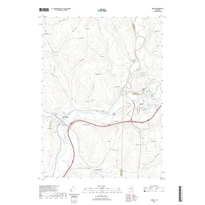
2019 Map of Sidney
USGS Topo · Published 2019About this map
The Susquehanna River and Unadilla River converge at the boundary of Otsego and Delaware counties, shaping the commercial and geographic heart of Sidney. This landscape reflects a long history of river-based settlement, where the Main Street Bridge and Sidney Municipal Airport serve as modern infrastructure atop older valley routes. To the west, Bainbridge sits along the northern bank of the Susquehanna, near the Saint Peters Churchyard Cem and Greenlawn Cem.
Find a feature on this map
105 named features on this map. Tap any name to fly to it.
Don’t see what you’re looking for? This feature index may not catch every label — zoom into the map to look around manually.
Map Details
Editions of this 2019 Sidney Map
This is the sole edition of this map. No revisions or reprints were ever made.
Other maps of this area

1902 · Coventry
USGS Topo · 1:62,500

1904 · Oxford
USGS Topo · 1:62,500

1905 · Nineveh
USGS Topo · 1:62,500

1915 · Unadilla
USGS Topo · 1:62,500

1918 · Unadilla
USGS Topo · 1:62,500

1924 · Deposit
USGS Topo · 1:62,500

1926 · Deposit
USGS Topo · 1:62,500

1943 · Sidney
USGS Topo · 1:24,000

1943 · Gilbertsville
USGS Topo · 1:24,000
1943 · Unadilla
USGS Topo · 1:24,000