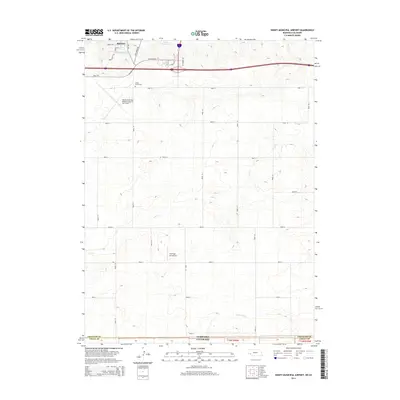
2014 Map of Sidney Municipal Airport
USGS Topo · Published 2014About this map
Sidney and the surrounding high plains of Cheyenne County are captured here during a period of modern aviation and agricultural expansion. The northern portion of the map is anchored by the Sidney Municipal Airport/Lloyd W. Carr Field, reflecting the area's role as a regional transport hub. Further south, the smaller Fehringer Aerodrome dots the landscape, while Grand Prairie Cem provides a point of interest for genealogists tracking local families. The terrain is defined by the drainage of Cow Cr and Cottonwood Cr, which cut through the strictly gridded section lines. Water management is evident through the presence of Verde Reservoir and Ruther Reservoir. Historical transit is represented by Old Post Rd and Fort Sidney Rd, which hint at the earlier military and mail routes that once traversed this portion of western Nebraska.
Find a feature on this map
34 named features on this map. Tap any name to fly to it.
Don’t see what you’re looking for? This feature index may not catch every label — zoom into the map to look around manually.
Map Details
Editions of this 2014 Sidney Municipal Airport Map
This is the sole edition of this map. No revisions or reprints were ever made.
Other maps of this area

1899 · Sidney
USGS Topo · 1:125,000

1953 · Peetz
USGS Topo · 1:24,000

1953 · Twin Buttes
USGS Topo · 1:24,000

1953 · Haystack Butte
USGS Topo · 1:24,000

1954 · Sterling
USGS Topo · 1:250,000

1954 · Scottsbluff
USGS Topo · 1:250,000

1958 · Scottsbluff
USGS Topo · 1:250,000

1958 · Sterling
USGS Topo · 1:250,000
1971 · Twin Buttes
USGS Topo · 1:24,000

1972 · Lorenzo
USGS Topo · 1:24,000