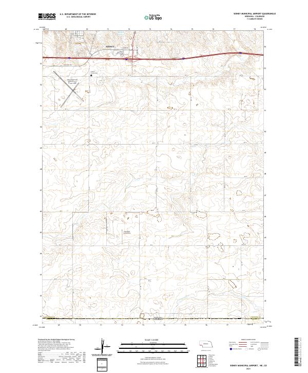
2021 Map of Sidney Municipal Airport
USGS Topo · Published 2021About this map
Sidney and its surrounding aviation landscape anchor this Western Nebraska survey, where the Sidney Municipal Airport serves as a primary hub. The northern portion of the map is defined by the community's outskirts, featuring local landmarks such as Grand Prairie Cem and the Ruther Reservoir. The land is characterized by a network of rural roads, including Old Post Rd, El Rancho Rd, and Fort Sidney Rd, which weave through the high plains terrain.
Find a feature on this map
35 named features on this map. Tap any name to fly to it.
Don’t see what you’re looking for? This feature index may not catch every label — zoom into the map to look around manually.
Map Details
Editions of this 2021 Sidney Municipal Airport Map
This is the sole edition of this map. No revisions or reprints were ever made.
Other maps of this area

1899 · Sidney
USGS Topo · 1:125,000

1953 · Peetz
USGS Topo · 1:24,000

1953 · Twin Buttes
USGS Topo · 1:24,000

1953 · Haystack Butte
USGS Topo · 1:24,000

1954 · Sterling
USGS Topo · 1:250,000

1954 · Scottsbluff
USGS Topo · 1:250,000

1958 · Scottsbluff
USGS Topo · 1:250,000

1958 · Sterling
USGS Topo · 1:250,000
1971 · Twin Buttes
USGS Topo · 1:24,000

1972 · Lorenzo
USGS Topo · 1:24,000