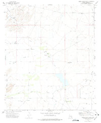
1972 Map of Sierra Bonita Ranch
USGS Topo · Published 1975About this map
Sierra Bonita Ranch serves as the focal point of this Graham County landscape, representing a legacy of ranching in the high desert during the early 1970s. The topography is defined by the Black Hills and the deep incisions of Aravaipa Canyon, where the drainage network of Deep Creek and High Creek shapes the terrain. This survey captures a specific pastoral infrastructure necessary for livestock management in an arid environment, noting numerous Water Tanks and specialized landmarks like the High Lonesome Windmill.
Find a feature on this map
18 named features on this map. Tap any name to fly to it.
Don’t see what you’re looking for? This feature index may not catch every label — zoom into the map to look around manually.
Map Details
Editions of this 1972 Sierra Bonita Ranch Map
This is the sole edition of this map. No revisions or reprints were ever made.
Other maps of this area

1922 · Willcox
USGS Topo · 1:125,000

1940 · Sierra Bonita Ranch
USGS Topo · 1:62,500

1942 · Sierra Bonita Ranch
USGS Topo · 1:62,500

1942 · Mt. Graham
USGS Topo · 1:62,500

1943 · Willcox
USGS Topo · 1:62,500

1943 · Sierra Bonita Ranch
USGS Topo · 1:62,500

1943 · Winchester Mts.
USGS Topo · 1:62,500

1945 · Mt. Graham
USGS Topo · 1:62,500

1945 · Winchester Mts.
USGS Topo · 1:62,500

1954 · Silver City
USGS Topo · 1:250,000