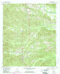
1974 Map of Silas
USGS Topo · Published 1987About this map
Gilbertown and Silas anchor this western Alabama landscape, captured during a period of active energy extraction and timber operations. The map documents an extensive Oil Field north of the Alabama and Northern RR tracks, with numerous Oil Wells peppered throughout the drainages of Little Mill Creek and Okatuppa Creek. These industrial features sit alongside a dense network of rural community landmarks, including Old Samuel and Souwilpa. A high concentration of family-linked sites and small congregations such as Harrison Cem, Coopers Chapel, and Allen Temple reflect the deep-rooted settlement patterns of the region. The terrain is defined by the winding paths of Souwilpa Creek and Turkey Creek, which create a complex system of branches and hollows where small settlements like Barrytown and Bolinger took hold along the primary rail and road corridors.
Find a feature on this map
38 named features on this map. Tap any name to fly to it.
Don’t see what you’re looking for? This feature index may not catch every label — zoom into the map to look around manually.
Map Details
Editions of this 1974 Silas Map
2 editions found
Other maps of this area

1953 · Hattiesburg
USGS Topo · 1:250,000

1958 · Hattiesburg
USGS Topo · 1:250,000

1971 · Ararat
USGS Topo · 1:24,000

1971 · Bladon Springs
USGS Topo · 1:24,000

1971 · Coffeeville Lock And Dam
USGS Topo · 1:24,000

1974 · Melvin
USGS Topo · 1:24,000

1974 · Millry North
USGS Topo · 1:24,000

1974 · Silas
USGS Topo · 1:24,000

1974 · Isney
USGS Topo · 1:24,000
1974 · Aquilla
USGS Topo · 1:24,000