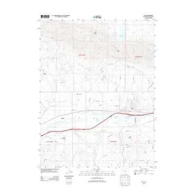
2013 Map of Silt
USGS Topo · Published 2013About this map
The Colorado River corridor dominates this topographic study of Garfield County, where the settlement of Silt serves as a local hub. The landscape is defined by a sophisticated network of irrigation systems necessary for high-desert agriculture, including the Farmers Irrigation Company Ditch, Last Chance Ditch, and Lower Cactus Valley Ditch. North of the river, the striking geological formation of the Grand Hogback rises above Cactus Valley, creating a natural barrier punctuated by Harvey Gap. To the south, the terrain climbs toward Weible Peak and is carved by seasonal drainages like Dry Hollow Creek and Mamm Creek. This era of the region is characterized by the coexistence of traditional ranching landscapes and modern infrastructure, evidenced by the proximity of the Garfield County Regional Airport to historical homestead areas. The map also documents local water management through several storage sites, such as the Grass Valley Reservoir and Rifle Valley Reservoir.
Find a feature on this map
66 named features on this map. Tap any name to fly to it.
Don’t see what you’re looking for? This feature index may not catch every label — zoom into the map to look around manually.
Map Details
Editions of this 2013 Silt Map
This is the sole edition of this map. No revisions or reprints were ever made.
Other maps of this area

1906 · Grand Hogback
USGS Topo · 1:125,000

1910 · Grand Hogback
USGS Topo · 1:125,000

1952 · Horse Mountain
USGS Topo · 1:24,000

1952 · Rifle
USGS Topo · 1:24,000

1957 · Leadville
USGS Topo · 1:250,000

1959 · Leadville
USGS Topo · 1:250,000

1960 · Leadville
USGS Topo · 1:250,000

1960 · North Mamm Peak
USGS Topo · 1:24,000

1962 · Leadville
USGS Topo · 1:250,000

1962 · New Castle
USGS Topo · 1:24,000