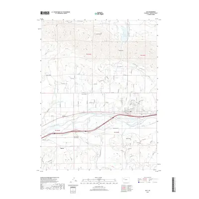
2019 Map of Silt
USGS Topo · Published 2019About this map
The Colorado River corridor defines this portion of Garfield County, where the Interstate 70 corridor and the town of Silt sit between the prominent Grand Hogback to the north and the high terrain of Weible Peak to the south. The landscape is characterized by an extensive network of irrigation infrastructure essential for the local agriculture, including the Grass Valley Canal, Rising Sun Ditch, and Lower Cactus Valley Ditch, which feed the namesake Cactus Valley. To the west, the community of Antlers lies near the Rifle city limits and the Rifle Garfield County Airport. Elevated features like Graham Mesa and Harvey Gap provide topographical contrast to the river valley, while the presence of the Grass Valley Reservoir underscores the long-standing management of water resources in this high-desert environment. This 2019 survey documents the modern layout of rural roads and water rights that have shaped settlement patterns in the region for over a century.
Find a feature on this map
87 named features on this map. Tap any name to fly to it.
Don’t see what you’re looking for? This feature index may not catch every label — zoom into the map to look around manually.
Map Details
Editions of this 2019 Silt Map
This is the sole edition of this map. No revisions or reprints were ever made.
Other maps of this area

1906 · Grand Hogback
USGS Topo · 1:125,000

1910 · Grand Hogback
USGS Topo · 1:125,000

1952 · Horse Mountain
USGS Topo · 1:24,000

1952 · Rifle
USGS Topo · 1:24,000

1957 · Leadville
USGS Topo · 1:250,000

1959 · Leadville
USGS Topo · 1:250,000

1960 · Leadville
USGS Topo · 1:250,000

1960 · North Mamm Peak
USGS Topo · 1:24,000

1962 · Leadville
USGS Topo · 1:250,000

1962 · New Castle
USGS Topo · 1:24,000